QuakeFeed is the #1 Universal Earthquake App for the iPad and iPhone!
COMPLETELY AD FREE!
NOW WITH PUSH NOTIFICATIONS
--> Free for all magnitude 6.0+ quakes worldwide
--> Custom notifications available via In-App Purchase
What makes QuakeFeed different from other earthquake apps?
--> No Ads!
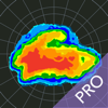
--> Beautiful, top quality maps by Esri
--> SEVEN basemap options, plus plate lines
--> Elegant, uncluttered user interface
--> Quick and very easy to use
--> Curated earthquake news and announcements
Our mapping features are truly stunning. Want a unique perspective on the quakes? View them on shaded relief or a map of the ocean floor. It will deepen your understanding - try it and you'll see what we mean!
QuakeFeed offers a variety of filter / sort options to let you see the quakes that are most important to you. Beautiful UI - check out our reviews, people love our simple, uncluttered design! And QuakeFeed is a universal app optimized for both the iPad and iPhone.
BASIC FEATURES
* Choose from several USGS Data Feeds: 1-day, 7-day, or 30-day with M1.0+ or M2.5+ quakes
* Push notifications for all 6.0+ quakes
* Quakes displayed in a list or on a map
* Earthquake news and announcements
* Drill down to quake details view:
-- Map zooms to quake location
-- Magnitude, time, lat/long, distance, depth
-- Link to quake details on USGS website
* Social media integration - share via:
-- Facebook
-- Twitter
-- Email
INTUITIVE USER INTERFACE
* Color-coded map symbols with optional magnitude display
* Quake list color-coded by magnitude
* Sort list by date, magnitude, depth, or distance from current location
* Filter list or map by magnitude
* Pull to refresh list
* GPS button for zoom to current location
* Specify units for distance and depth (km or miles)
* All screens work in portrait or landscape mode
ENHANCED MAPPING CAPABILITIES
* Seven different basemap options:
-- Street Map
-- Satellite Imagery
-- Ocean Bathymetry
-- Shaded Relief Map
-- Physical Map
-- Terrain Map
-- Topographic Map
* Display plate lines as a map overlay
* Pinch to zoom / drag to pan
* One touch zoom in / two touch zoom out
SUGGESTIONS? QUESTIONS?
Contact us at support@artisanglobal.com or visit http://quakefeed.net -- we're always striving to improve and we appreciate your feedback!